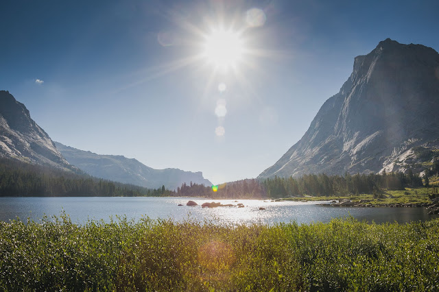
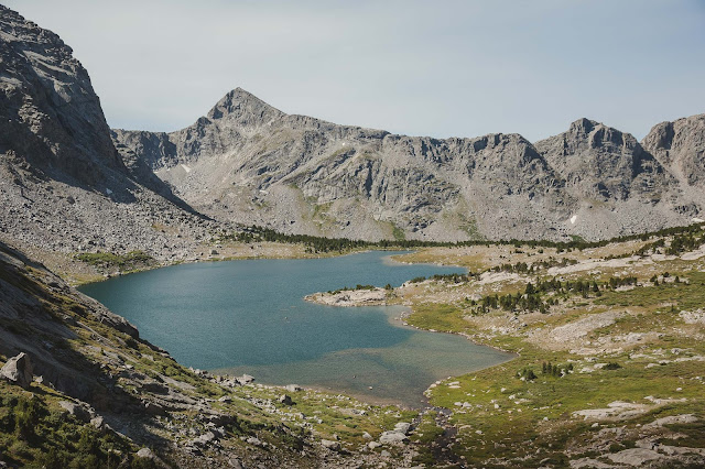
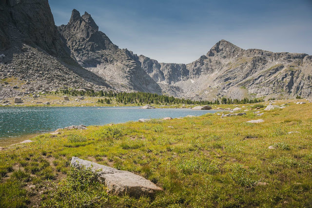
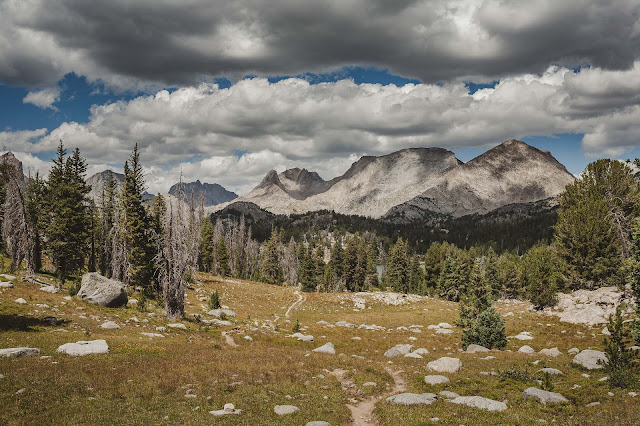
Through the Winds.
Before last summer, I had visited the Wind River Range two times, both in the same area: Cirque of the Towers. Once with Cosmo back in 2008 on one of our first autumn holidays and again ten years later with K and S. Sefton was all of a year-and-a-half so we carried him. It was incredible.
Though the time I've spent there pales in comparison to either the Cascades or the Sierras, the Winds nonetheless have captivated me. Not just because they're the birthplace of the Green River, but because they remind me in a lot of ways of the Sierras. Only more hospitable.
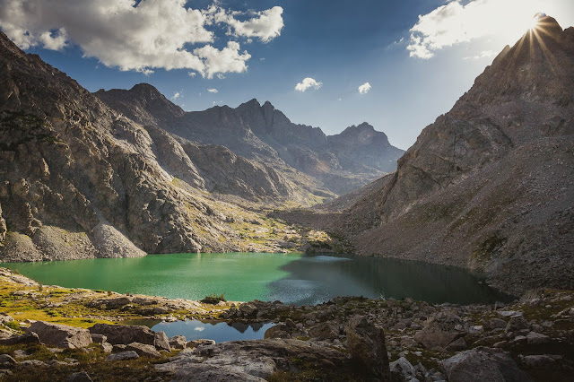
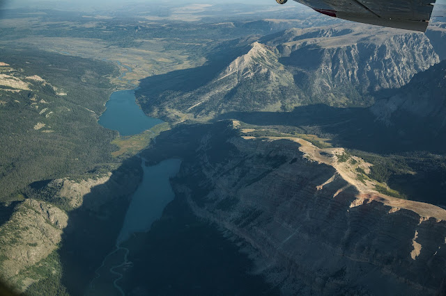
The route we carved for ourselves last year, Matt, Ben, and I, took us from near their southern terminus at Big Sandy through most of their length where the Green River empties into the northern plains of Wyoming before turning south into Utah. It was mostly off-trail or on trails barely-used. We crossed the Continental Divide a total of five times. All told, we hiked almost a hundred miles. We saw some incredible terrain and I was mesmerized by two particular spots: the valley where the Green is born and a basin tucked up under the Divide.
Our trip started with my buddy Joel dropping me off at Pangborn and me getting to put in the gate code and walking out onto the private landing area. I saw Matt's Cessna coming in on approach (left hand pattern) and shouldered my backpack. It was a Friday morning at the end of August. The next eight days would be a proper adventure.
On departure out of Wenatchee the hills above the Columbia were cloaked in August brown
Three-plus hours later we flew past the Tetons (the summit of the Grand Teton is hidden in the clouds right of center and Highway 22 that winds over Teton Pass is etched in the mountains at bottom)
Matt in his element
Immediately after Teton Pass, we flew over the Palisades Wilderness Study area where coincidentally Matt did his geology undergrad research
Matt preparing for arrival at Ralph Wenz field in Pinedale, Wyoming
The Winds come into view…
Locking up the Cessna for a week in the mountains
It's range country along the Green River north of Pinedale, Wyoming (on our way to leave the rental car at the Green Lakes trailhead and be shuttled down to Big Sandy)
Following the long travel day, by the time we crossed the Divide for the first time into Cirque of the Towers it was getting dark
Morning from our campsite just above Lonesome Lake (Pingora Peak towers to the left)
Sunrise behind Mitchell Peak
The always-impressive Warbonnet
Lonesome Lake and Mitchell Peak on the right
Warbonnet and Warrior Peaks reflected in a tarn
Lonesome Lake and Mitchell Peak on the climb to Texas Pass
The last push to the pass…
Descending the steep side of Texas Pass
Reaching level - albeit still rocky - ground at the informally-named Texas Lake
The backside of the Cirque of the Towers was new territory for me. Also, it was fascinating seeing both the other side of the famous cirque as well as the landscape to its north. At one point in the afternoon, a lenticular cloud developed into a spectacular wave formation, fully reminiscent of the Sierra wave.
We never saw a single person this entire day…
The next valley over was absolutely stunning. The scale, the sheer immensity of the granite walls, left me hanging far behind Matt and Ben, taking photographs. Enjoying the afternoon and the place.
Not sure how the 'N' or 'W' formed on the granite face, but it sure is reminiscent of the 'W' in Woolley…
Not evident in the photographs except if looking closely at the water in the third and fourth ones was the wind. It was howling easily at twenty-five miles per hour and gusting. Where I took the photograph of my boots was our first, slightly-sheltered campsite we eventually had to abandon for lower ground to get away from it lest Matt's über-light tents get shredded. It calmed down in the evening, as downslope winds tend to do.
The next morning, day three, dawned calm and cool. Though we'd climb three passes that day, none took us over the Divide.
Matt climbing the first pass
Looking back at that epic valley…
And, just before we got to the pass, the last peek of the backside of the Cirque of the Towers
From the west, the pass looks fairly mellow
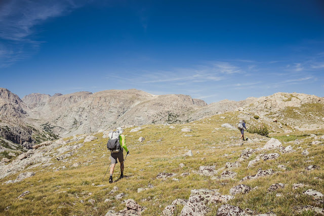
Matt and Ben cross a high plateau; in the Winds, there were many of these, almost at odds with the rest of the very rugged and alpine terrain
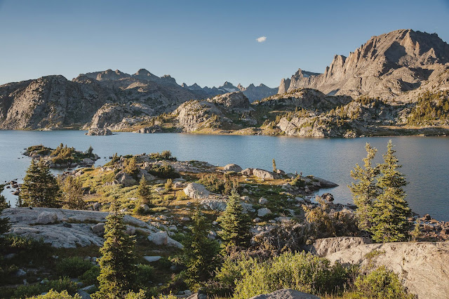
Alpine lakes with islands are always particularly photogenic
The surrounding scenery doesn't hurt…
After a little confusion about which pass to climb and thankfully Matt and Ben being able to hear my shouts across the valley, Matt tops out at the correct pass
The view back…
From the pass we had a lot of ground to cover (and willow to bushwhack through)
That afternoon was tedious; Matt and Ben navigate the terrain with the pass we had come from out of view to the right of center
It was a spectacular valley although the drab afternoon light left photographs lacking
Now that tedious valley long behind us, we navigated our way through forest interspersed with small lakes, trying not to get too confused by the topography
Eventually we found our destination for camp that evening. Matt's tent setup included options for two of us and a single. We came to call the one-person tent 'The Palace'. The lucky one who got that tent was treated to a peaceful and spacious slumber.
This small pass revealed our route past this secluded lake, over the rise right of center and onward.
That morning was spent winding around lakes and picking our route to the next pass, putting us once again on the east side of the Continental Divide. Traverses of mountain ranges are essentially a two-step process:
- Go up a pass
- Go down a pass
Crossing the Divide again, we could now see our next objective - the pass along the ridgeline along the distant horizon. Camp for that night was still beyond that…
Matt and Ben traverse another high plateau
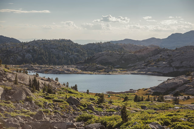
This chain of lakes was beautiful, quiet, and (as much of the Winds beyond the Cirque of the Towers) devoid of other people
The final lake of the three before we'd climb up to the saddle now right of center in the distance
Matt crosses that pass as we enter another basin. Here we did come across a pair of hikers, the first we had seen since the second day leaving the Cirque of the Towers
A cool spot, secluded…
We'd drop down and find a camp for the night at the far end of this lake, only to climb back out of that basin the next morning, back up into the alpine
That morning we woke up in perhaps the most uninspiring spot of the entire trip, and (spoiler) we'd camp that night in one of the most spectacular spots. We'd traverse the most rugged and serene terrain of our route, while enjoying the splendor of a basin bathed in late afternoon light. It'd be a long day.
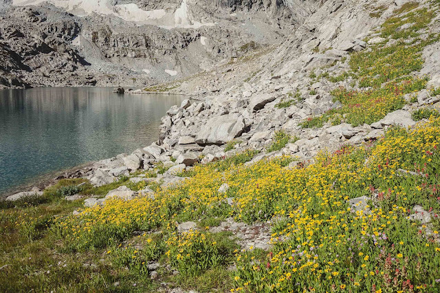
Even though we had entered the most alpine section of the route, the landscape was still filled in places with flowers.
From the top of that pass we could see our route ahead to our next pass, across and above the glacier in front of us, the low spot left of center
A close-up of our next pass and our final crossing of the Continental Divide
The glacier we'd have to cross
A glacial meltwater pond, from which the water was perfectly cold if not a little silty
Matt and Ben follow my tracks across a mellow section of the glacier
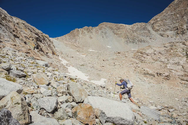
Weaving up along the edge of the glacier to gain the loose rocky cliffs that led up to the pass
A close-up of the glacier
Ben and Matt unwind a little atop Indian Pass. Though we still had a bunch of miles ahead of us, the hardest part of our route was behind us. It was a good moment. This was Day 5, August 30, 2022
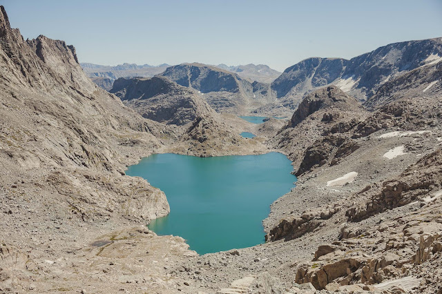
Looking west from this pass into the basin we'd have the pleasure of traversing, a highlight of our route
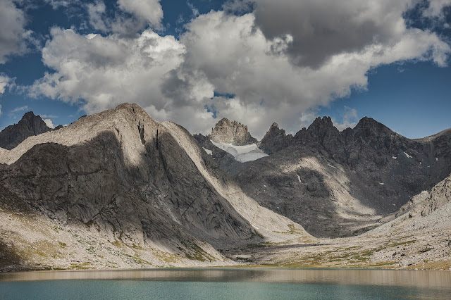
Sprawling high alpine basins, above treeline, scoured from granite and littered with crystal-clear lakes are always incredible. They remind me of the Enchantments to some degree. A few come to mind, this one in the Winds as well as those I've visited in the Sierras. We were fortunate that day to get a smattering of clouds, scattering the light, highlighting the peaks of the Divide while cloaking closer ridgelines in shadow.
Eventually, as we moved further from the Divide the basin opened up to the sprawling plateaus of the western edge of the Winds. Matt and Ben were surprisingly wearing down while I pushed us further ahead to a campsite I had etched in my mind. They didn't quite understand. Somewhere along the way, in my own fatigue I suppose, I dropped that section of our map, gone. Fortunately we hit trail and knew where we were headed, even if it was still several miles away. Miles, they were, before we'd sleep.
Looking back at the basin, Mount Fremont (second-highest peak in the Wind Rivers) at far left, the pass from which we had come hidden from view just right of center
Looking north at our route the next day after that night's short detour to camp at Island Lake
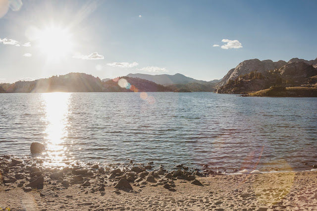
A sandy beach along the eastern shore of Island Lake
This was the spot I had in mind. Although a popular spot, Island Lake has long-held a grip on my imagination. So I blocked out the crowds and enjoyed the scene as the clouds disappeared and the sun sank lower
There are plusses to crowds. In our case, a camp neighbor who dropped by with fresh fish he had just caught and grilled over an open fire. Only after Matt and Ben devoured what the man had gifted us did I feel they forgave me for dragging them to this spot rather than camping at literally any of dozens of spots in the basin we had just traversed.
After a final parting shot from Island Lake, we made our way into Titcomb Basin. A world-class hiking destination, we were surprised at how few people we saw as we hiked several miles from one end to the other. In fact, we only passed by two small groups of people. The loneliness and silence of the Winds held true even there.
For me, however, Titcomb was a means to an end. I knew what lay ahead: the basin from which the Green River came to life. One more high alpine pass rose between us and that spot which had also occupied much of my thoughts on this trip.
The pass for which we were headed is right of center in the first photograph above. As we climbed, this was the only time we had to put on rain shells as a squall moved quickly overhead, then was gone as fast as it had come.
Surprisingly, given the emptiness of Titcomb Basin now behind and far below us, we ran into four groups of people on our way up this very remote pass. Kudos to the parents bringing their two kiddos, particularly after we then watched a couple turn around given the steepness and looseness of the rocks leading up.
From the top, Titcomb Basin is out of view to the right. The highest and most rugged peaks of the Wind Rivers lie in the frame and further north, to the left. A trip for another time…
Turning the other direction, west, reveals the headwaters of the Green River, the first canyon it carves, and our campsite for that night, far in the distance
Matt and Ben tinker their way down the west side of the pass
The clouds and weather continue moving west, away from us
The pass as I also negotiated a way through the loose rocks, down, down, down
Close-up of the Stroud glacier, the source of the Green River
Matt and Ben lost in the landscape beneath the pass, already a seemingly long climb away…
Eventually, we got to our camp. Unlike the previous day and despite the pass we had just climbed and descended, that day was an easy one in comparison. We had time to relax, to jump into the lake, over and over again. Brew espresso. It was warm, a slight breeze. The light, simply amazing.
As evening came, the clouds broke up, the moon set, and the stars came alive. Night, and utter stillness.


